Hurricane Vance Remains Off Mexico’s Coast


Posted on 10/24/26 at 18:39
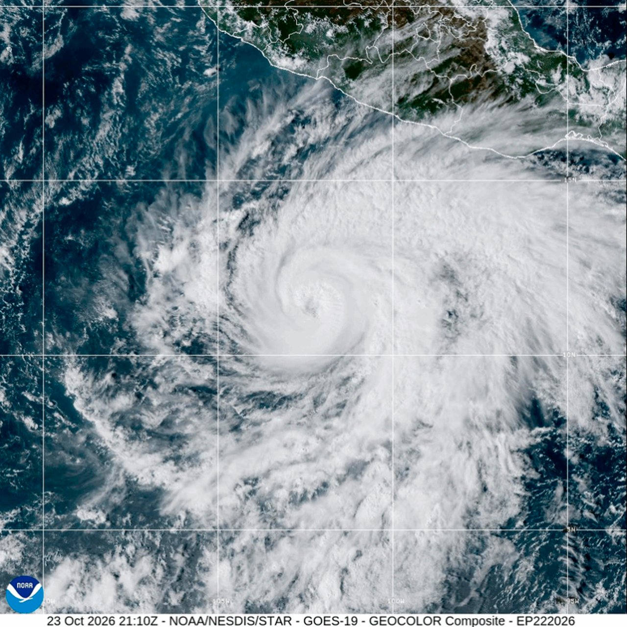
The Hurricane Vance, a category 2 storm in the Pacific, remains far from Mexico's coast, but its circulation is bringing rain to Michoacán, Guerrero, and Oaxaca. According to the U.S. National Hurricane Center (NHC), the storm is expected to start weakening from Saturday night, October 24.
- As of 3:00 a.m. (Central Time) on Saturday, October 24, the storm's center was about 590 km south-southwest of Acapulco, with sustained winds of 175 km/h.
- There are no coastal watches or warnings, and the predicted trajectory keeps the storm over the ocean.
- The NHC forecasts fluctuations in intensity on Saturday and a gradual weakening from that night and during Sunday.
Why it matters: although Vance does not threaten to make landfall, its cloud bands can bring heavy rain to mountainous areas and high waves to the coast. It's a good idea to follow its evolution, without alarm, especially if you have family in the southwest of the country.
Where it is and how strong it is
According to the NHC's bulletin 12, the center of Vance was also about 750 km south-southeast of Manzanillo. The storm is moving northwest at 11 km/h and will continue to do so over the weekend. Hurricane-force winds extend up to 45 km from the center, and tropical storm-force winds up to 240 km.
| Data | Vance by the numbers |
|---|---|
| Category | 2 |
| Sustained winds | 175 km/h (110 mph) |
| Gusts | 212 km/h, according to the Secretariat of the Navy (Semar) |
| Pressure | 965 mb |
| Distance from Acapulco | about 590 km south-southwest |
| Movement | northwest at 11 km/h |
| Coastal warnings | None |
| Forecast | Gradual weakening from Saturday night |
Rain and waves in the southwest of the country
On Friday, October 23, Vance became a category 2 storm. That day, the National Meteorological Service (SMN), cited by EFE, forecast heavy rain in Michoacán and Guerrero, showers in Oaxaca, and waves of up to three meters on the coast of Guerrero.
The Semar reports cloudy to overcast skies over the coasts of Michoacán, Guerrero, Oaxaca, and Chiapas, and waves of between 4.8 and 5.4 meters near the system, i.e., in open sea. Authorities asked people to exercise extreme caution.
A very active Pacific season
Vance formed on Wednesday, October 21, south of Guerrero. If you want to review how it started, you can read our note from when Vance was still a possible cyclone.
The Pacific season runs from May 15 to November 30. According to the National Water Commission (Conagua), there have been 20 cyclones: 10 tropical storms, two category 1 or 2 hurricanes, and eight category 3 to 5 hurricanes. These eight major hurricanes exceed the five that were forecast.
What to do if you live on the coast or have family there
- Follow official alerts from the SMN and Civil Protection, which will update information if something changes.
- Avoid the sea: the waves can be dangerous even if the sky appears clear.
- Be careful in mountainous areas of Guerrero and Michoacán, where rain can cause landslides and flooding of rivers and streams.
- Stay in touch with your relatives and review the forecast for the next few days with them.
Sources: National Hurricane Center (NHC), bulletin 12; Secretariat of the Navy; EFE. Data consulted on October 24, 2026.
Main photo: EFE/NOAA.