Josephine to Move Away from US, but Leave Dangerous Waves and Flooding Risk


Posted on 10/22/26 at 08:03
- Josephine will move away from the United States.
- Dangerous waves affect the coast.
- Strengthening is expected during its transition.
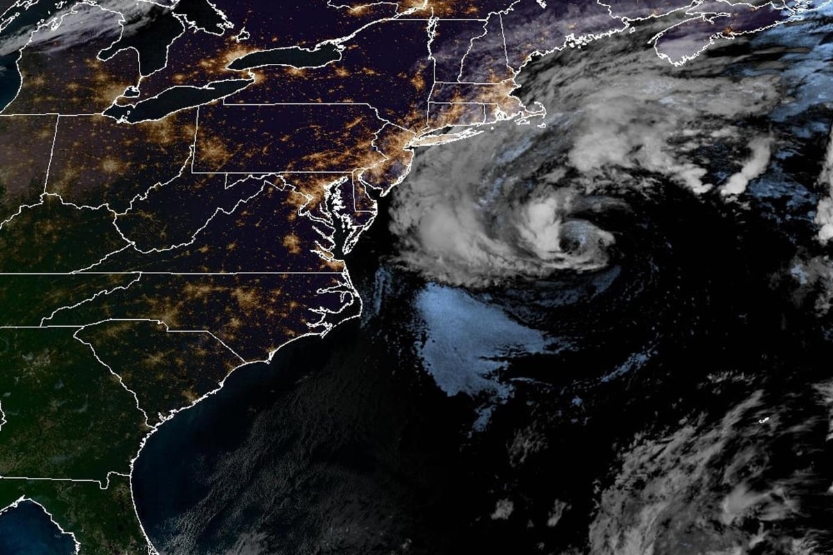
Subtropical Storm Josephine formed on Wednesday, October 21, in the Atlantic. Although its trajectory points away from the United States, its effects reach the East Coast.
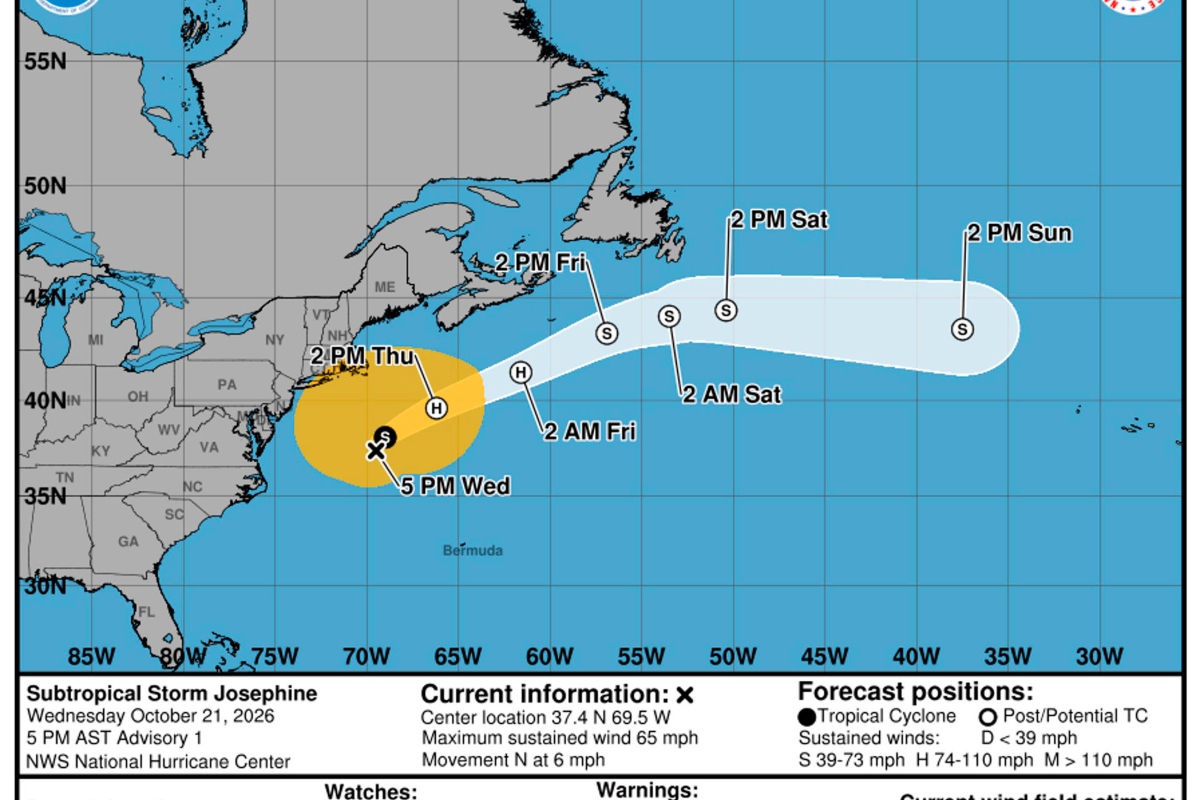
In the 5:00 p.m. Eastern Time bulletin, the National Hurricane Center (NHC) reported sustained winds of 100 kilometers per hour, with higher gusts.
Its center was approximately 425 kilometers south of Nantucket, Massachusetts, and 940 kilometers southwest of Halifax, in the Canadian province of Nova Scotia.
The system was moving north at nine kilometers per hour. The forecast anticipates a turn to the northeast on Thursday and a significant acceleration of its movement.
Josephine Could Reach Hurricane-Force Winds as Post-Tropical Cyclone
The area of low pressure well off the Mid-Atlantic Coast has acquired enough subtropical characteristics that it is now considered a Subtropical Storm, named Subtropical Storm Josephine. The latest track from the National Hurricane Center as of 5 PM EDT on October 21st is shown. https://t.co/FNzZBkeCWq
— NWS Eastern Region (@NWSEastern) October 21, 2026
The predicted trajectory will keep Josephine's center south of Nova Scotia and Newfoundland. As it advances, it will increase its distance from the US mainland.
The NHC expects it to maintain subtropical characteristics until the early hours of Thursday. Later, it could intensify as it changes its structure and becomes a post-tropical cyclone.
The forecast contemplates hurricane-force winds during this transition. This intensity does not mean that Josephine will necessarily be classified as a tropical hurricane.
The distinction is relevant: losing subtropical characteristics does not mean weakening. Therefore, the change in classification should be interpreted together with the predicted intensity and hazards.
US East Coast: Waves, Rip Currents, and Flooding
The main risk for numerous coastal communities will be at sea. Josephine's swells affect sectors of the East Coast and the Canadian Atlantic.
This wave activity can generate dangerous conditions for swimmers and rip currents. The fact that the center remains far from land does not eliminate the risks on the beaches.
Gusts with tropical storm intensity could also be recorded in parts of the US Northeast coast until Thursday, even as the system begins to move away.
YOU MAY BE INTERESTED: A super typhoon and a potential storm: what's happening in the Pacific with Champi and Vance
In sectors of the Mid-Atlantic, minor coastal flooding, locally moderate, continues. This could repeat during the rest of the week, especially around high tide.
No Coastal Alerts for Josephine: What Residents Should Watch For
When the initial bulletin was issued, there were no coastal watches or warnings associated with the cyclone. This does not mean the absence of hazardous conditions on the coast.
Residents should follow NHC updates and local forecasts, especially if they live in low-lying areas or plan to travel on coastal roads.
Those planning to visit beaches or engage in maritime activities should check conditions before heading out and follow the instructions of authorities, lifeguards, and navigation officials.
The evolution requires observing both the trajectory and its effects: Josephine can move away from the United States while dangerous waves and flooding around high tide persist.
SOURCE: EFE