Hurricane Polo Reaches Historic Strength, Puts Southwest US on Alert


Posted on 09/24/26 at 10:31
- Polo reached historic Category 5
- New Mexico faces dangerous flooding
- Mexico maintains active coastal alerts
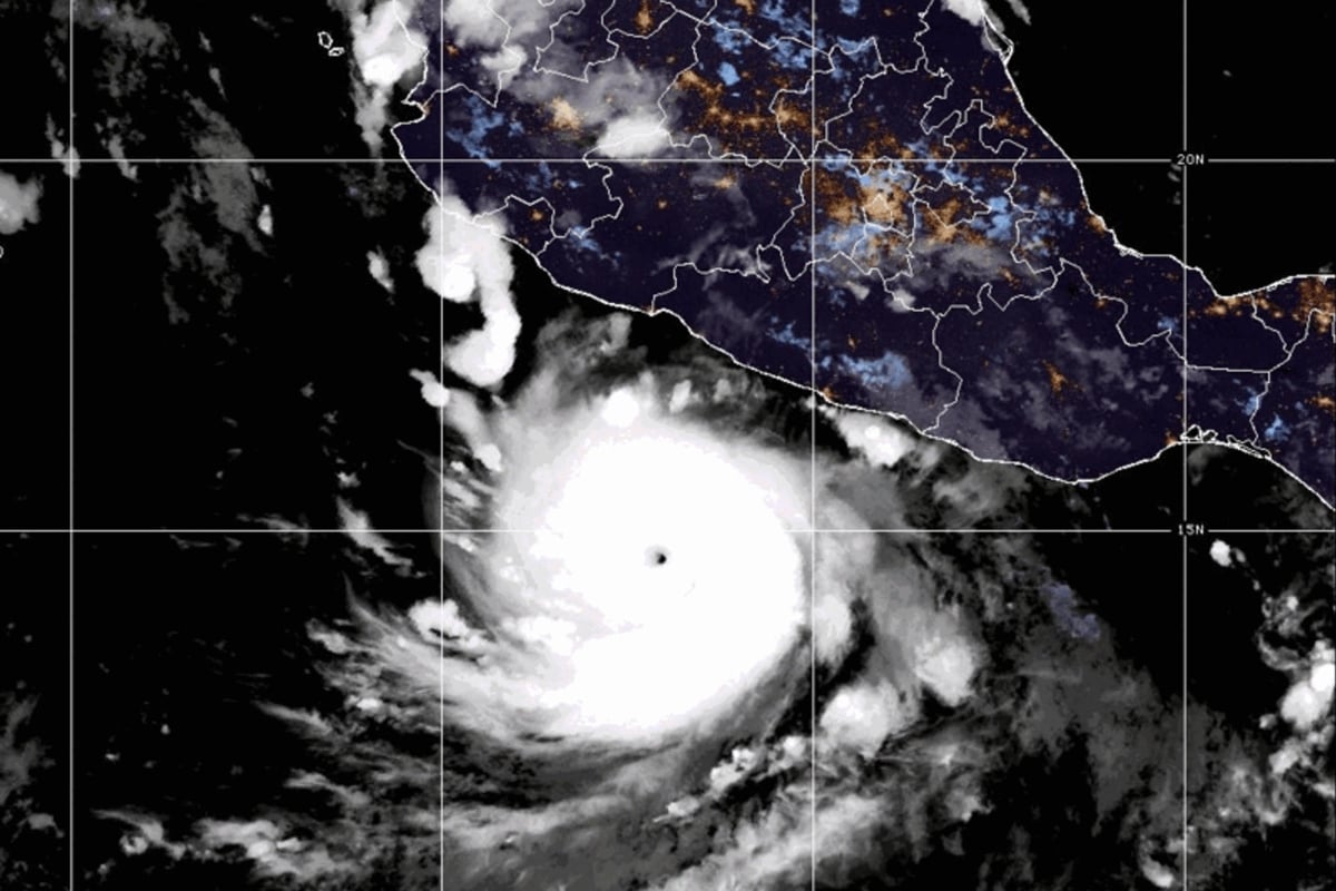
According to foxweather, Hurricane Polo underwent an extraordinary intensification in the Eastern Pacific, reaching Category 5 with maximum sustained winds of 180 mph (285 km/h), becoming one of the most intense cyclones recorded in that basin.
A NOAA hurricane hunter mission found a minimum pressure of just 892 millibars on Tuesday, a value that places Polo second only to Hurricane Patricia in 2015 among the lowest pressure records in the Eastern Pacific.
The maximum strength was short-lived. By noon on Wednesday, September 23, the National Hurricane Center classified Polo as a powerful Category 4 hurricane, with sustained winds of 145 mph (230 km/h).
The cyclone was located approximately 150 miles south-southwest of Zihuatanejo and was moving northwest at 5 mph, as its outer bands began to affect sectors of the Mexican coast.
New Mexico Faces Flooding as Tropical Moisture Advances
‼️ RAPID INTENSIFICATION: Hurricane Polo has exploded in intensity in under 24 hours into a monster Category 5 storm. This explainer shows just how fast the behemoth of a system went from 50 mph to 160 mph in just 21 hours. Stay with FOX Weather as we continue to follow Hurricane… pic.twitter.com/JwRp25XwGS
— FOX Weather (@foxweather) September 22, 2026
The effects associated with tropical moisture extend far beyond Polo’s center, increasing the availability of moisture for storms capable of generating dangerous flooding in parts of the US Southwest.
New Mexico reported flooding and rescue operations, while the National Weather Service maintained a watch over different sectors of the state ahead of new rounds of heavy rain.
On Wednesday, the NWS issued a flash flood warning for the area affected by the South Fork fire in Lincoln County, after radar and rain gauges detected heavy precipitation.
A flood watch also remained in effect until Thursday night for areas of central, eastern, and southeastern New Mexico, where additional precipitation could trigger new flash flooding.
Mexico Remains Under Threat from Polo’s Rains and Landslides
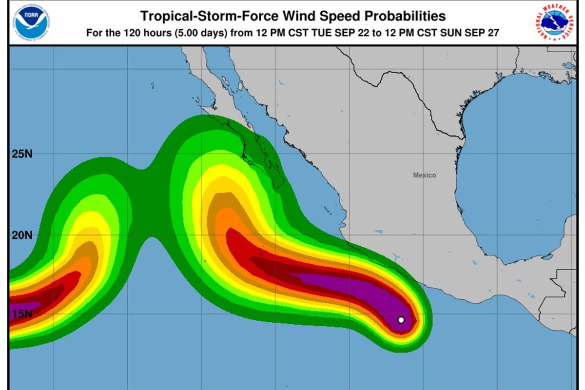
Although the hurricane’s center remained offshore, Polo continued to pose a risk to the Mexican coast due to its rain bands, strong winds, dangerous surf, and possibility of flooding and landslides.
The NHC maintained a tropical storm warning from Tecpan de Galeana to Punta San Telmo, in addition to a watch from west of Punta San Telmo to Playa Pérula.
Guerrero and Michoacán are among the areas exposed to the most intense rains, while the slow movement that initially characterized the cyclone increased concerns about significant water accumulation.
The forecast indicated a northwestward movement, parallel to the coast, although authorities insisted that small variations in trajectory could significantly modify the impacts recorded on land.
What Families Should Know About Flooding
For New Mexico residents, the main threat does not come from a direct impact from Polo, but from an atmosphere laden with moisture capable of fueling torrential rains and triggering flash flooding.
Areas burned by wildfires require special attention because the terrain can absorb less water, increasing the possibility of rapid mudflows, debris, and water during intense storms.
Motorists should avoid flooded roads even when the water appears shallow, as conditions can change quickly and the current can hide damage or sweep away vehicles.
Families in areas under watch should follow National Weather Service alerts and local authorities, identify routes to higher ground, and be prepared to act immediately if they receive an evacuation order.