Hurricane Isaías Makes Landfall in Florida as Category 2 with 105 mph Winds


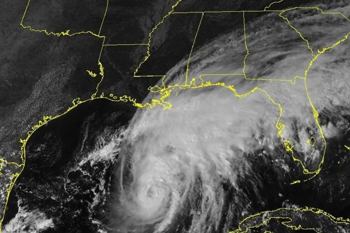
Posted on 10/10/26 at 11:38
Hurricane Isaías made landfall Friday night near Destin, in northwest Florida, as a Category 2 hurricane with winds of 105 miles per hour, according to information from the National Hurricane Center (NHC).
The impact on the Panhandle region triggered alerts for storm surges, flooding, and possible tornadoes, threats that can persist even after the system loses intensity.
Weather authorities warned that the danger is not limited to coastal communities. The rain and wind could extend into the interior of the southeastern United States.
Atlanta, Georgia, is among the cities that could experience adverse conditions as the storm moves north.
Hurricane Isaías Hits Florida: Alert for Winds and Tornadoes
The hurricane Isaias, is strongly hitting Florida
https://t.co/KoSBuwwEPZ
— Alertageo (@alertarojanot) October 10, 2026
The NHC reported through its X account that the center of the hurricane made landfall near Destin, accompanied by maximum sustained winds of nearly 105 mph.
Category 2 corresponds to speeds between 96 and 110 mph on the Saffir-Simpson scale and is capable of causing significant damage to homes, trees, and power lines.
However, the hurricane’s classification does not reflect all its dangers. Flooding and storm surges can pose serious threats, regardless of wind speed.
Coastal communities in the Panhandle should pay special attention to rising sea levels, particularly in low-lying areas and along roads near the coast.
Storm Surge and Flooding: The Main Dangers
HURRICANE ISAIAS MAKES LANDFALL ON THE COAST OF FLORIDA
🌀
#Isaias makes landfall in the city of Destin, Florida USA 🇺🇸 with winds of 165 km/hStorm surges hitting the coasts of Florida and Alabama. Exercise extreme caution, dangerous conditions due to heavy rain and flooding spreading inland.
#Hurricane #Isaias
October 9/20:30h— Geól. Sergio Almazán (@chematierra) October 10, 2026
Storm surge occurs when strong winds push ocean water onto land, dangerously raising the sea level.
This phenomenon can flood homes, block evacuation routes, and turn normally safe areas into high-risk zones for a few hours.
Intense precipitation could also cause sudden flooding, especially in neighborhoods with limited drainage and communities near rivers or streams.
Meteorologists also warned about the possibility of tornadoes associated with the rainbands, a threat that can develop quickly.
What Will Happen to Hurricane Isaías as it Moves Towards Georgia?
Although Isaías is expected to lose strength as it moves over land, its effects could persist far from the point where it made landfall.
Atlanta and other communities in Georgia could experience heavy rain, gusty winds, and traffic complications as the system advances.
For Hispanic families living in Florida and Georgia, it is essential to consult official alerts and prepare supplies in case of possible power outages.
The NHC recommends following weather updates while local authorities determine which communities need additional protection measures.
Source Telemundo.